
 English
 English (US)
 English (AU)
 English (NZ)
 English (SA)
 Français
 Français (CA)
 Italiano
 Deutsch
 Español
 Nederlands
 Português
 Polski
 العربية
 עברית
עברית Svenska
 Dansk
Dansk Suomi
Suomi Norsk
Norsk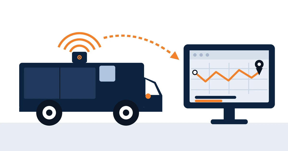
The technology behind vehicle tracking is genuinely simple. Understanding it takes about four minutes, and it immunizes you against a surprising amount of sales language.
This article assumes you already know roughly what the technology is for. If that is not yet true, the place to start is the plain-English guide to telematics.
Step one: the satellites do less than you think
Several global satellite navigation systems are in orbit, each broadcasting a continuous timing signal. A receiver on the ground picks up the signals from several satellites at once, measures the tiny differences in how long each one took to arrive, and calculates its own position from them.
The whole exchange is one-way. The satellites broadcast; they receive nothing. A tracker does not report to a satellite, and no satellite has any idea that a particular tracker exists. Positioning is free, passive and available to anyone holding a receiver.
The scale of that broadcast infrastructure is public information. The European Union’s Galileo system alone comprises more than 30 satellites orbiting at 23,000 km and has been operational since December 2016 — and it is only one of several constellations a modern receiver can listen to.
Which means the actual tracking does not happen in space at all.
Step two: the device works out where it is and what is happening
The unit in the vehicle holds the satellite receiver, plus an accelerometer that measures changes in speed and direction. That is the component which decides something has just happened and raises an event.
If the device is also connected to the vehicle’s internal data network, it can read what the vehicle already knows about itself: fuel consumed, engine hours, fault codes, odometer, seatbelt status, the state of auxiliary equipment. This is the dividing line between a basic tracker and a genuine fleet management device, and it is worth establishing which of the two you are being quoted for.
Step three: the mobile network does the actual tracking
The device packages up position and status and sends it over the mobile network to a server. This is where tracking actually happens, and it is why network coverage matters and satellite coverage largely does not.
In a coverage gap a competent device stores readings locally and uploads them when signal returns. Nothing is lost: live visibility pauses, the historical record does not. Mobile coverage across the UK is not uniform, so for rural operations and cross-border work, roaming or multi-network SIMs that can use whichever network is strongest make a material difference.
Step four: software turns it into something you can act on
Maps, reports, alerts, driver scores. And in the implementations that actually produce results, automatic notifications into other systems — so a completed job updates the scheduler, a fault code raises a workshop task, and an arrival triggers a customer notification.
If any of the vocabulary in a quotation is unfamiliar, it is defined a line at a time in the telematics glossary.
How the device gets fitted
Diagnostic port. The device plugs into the socket most vehicles carry under the dashboard. Fitting takes minutes, needs no downtime and moves between vehicles easily. It is also visible, easily unplugged, and on some vehicles the data it can reach is more limited.
Hardwired. The device is wired discreetly into the vehicle’s electrical system, typically in 45 minutes to two hours. It is concealed, tamper-resistant and generally provides fuller data. It does require a competent installer: poor installation is one of the few genuine risks to a vehicle warranty.
Self-powered. A battery unit with no connection to the vehicle at all, used for trailers and unpowered assets. No installation and no wiring, but limited data and a battery to manage.
The choice is worth making deliberately, because it is rarely revisited. Department for Transport figures record 4.88 million licensed light goods vehicles and 520,000 licensed heavy goods vehicles in the United Kingdom at the end of December 2025, and the fitting method chosen for a pilot of five vans is not always the one that suits five hundred.
What actually affects accuracy
Position is typically accurate to within a few meters in the open, degrading among tall buildings, in dense woodland and inside multi-storey car parks. Two factors matter considerably more than the satellites do.
Both traces above come from the same journey. The only difference is how often the device was asked to report.
Reporting interval. A device reporting every ten seconds draws a route that follows the road. One reporting every five minutes cuts the corners, and can appear to have taken a route it never took. This is the single most common cause of complaints that the tracking is wrong, and it is a configuration decision rather than a limitation of the technology.
How speed is measured. Satellite-derived speed is generally accurate but can spike briefly. Speed read from the vehicle’s own systems is better. And a speeding report compared against the actual posted limit depends on the quality of the underlying speed-limit map, which is why occasional disputes arise on recently changed roads. Ask which method is used before you rely on a speeding report in a disciplinary conversation.
It is worth being precise about what the published accuracy figures actually cover. The United States government commits to broadcasting the GPS signal with a daily global average user range error of 2.0 m or better, with 95% probability, and recorded an actual figure of 0.643 m or better on 20 April 2021. Those commitments describe the signal in space, not the device receiving it. What you see on a screen also depends on satellite geometry, on what is blocking the sky, and on the quality of the receiver itself. Galileo is measured the same way: the European GNSS Service Centre reported signal availability averaging at least 98.31% a month across every single-frequency and dual-frequency combination in the first quarter of 2026.
Two questions worth asking before you buy
What is the standby current draw, and at what voltage does the device stop drawing power? For vehicles that stand for weeks — seasonal fleets, standby units, trailers — those two numbers decide whether you come back to a flat battery. Any competent supplier can answer both immediately.
How are firmware updates delivered? If the answer involves bringing vehicles to a workshop, then over a five-year contract the fleet will quietly fall behind on security and functionality, because nobody ever schedules 300 vehicles for a software update. Remote updating is not a luxury feature; it is what determines whether year four looks like year one.
Both belong on a longer list of things to establish before signing anything, which is set out in the fleet technology buyer’s guide.
Sources: GPS.gov, United States government — GPS Accuracy, reporting the commitment in the GPS Standard Positioning Service Performance Standard (daily global average user range error of 2.0 m or better with 95% probability; 0.643 m or better measured on 20 April 2021; the commitments apply to the signal in space, not to GPS devices). European Union Agency for the Space Programme — Galileo (more than 30 satellites orbiting at 23,000 km; operational since December 2016). European GNSS Service Centre — Galileo Performance Reports, Quarter 1 2026 (signal availability of at least 98.31% as a monthly average for every single-frequency and dual-frequency combination). Department for Transport — Vehicle Licensing Statistics, United Kingdom: 2025, published 29 April 2026 (4.88 million licensed light goods vehicles; 520,000 licensed heavy goods vehicles, end December 2025).